
Vestvågøy
- 65
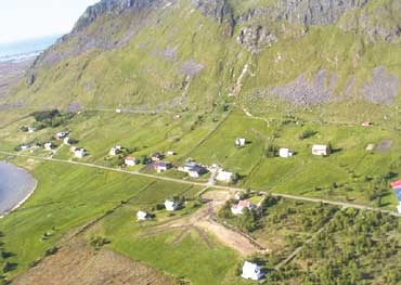
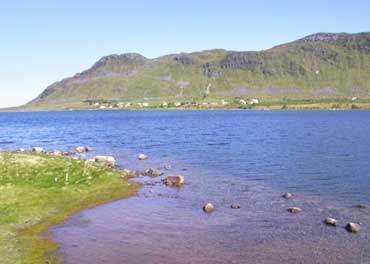
Borgfjord Ytre
|
Site/Artefact Type Site
Number NGO Grid
Reference Map (
1:50000) List of Sites
and Artefacts Interactive
Map |
|
 Description
Registrations from 1971 supply us with
the following description:
3 Burial Cairns, situated at "Strands" farm nr.
101/0 600 m SSE of the farm houses
Furthest to north:
Boat shaped cairn, 10 x 4 m, c. 0,5 m high
1 m SSW of 1: Round shaped cairn, 11 m in dm, c. 0,8 m high
8 m W of 1: Circular cairn, 8 m in dm, c. 1 m high
Information about these burial cairns existed in the 17th century.
Finds that are received earlier at the farm:
1. From 1882: (museumnumber Ts. 504): A belt buckle of copper, found in a little hill during ploughing in the area. Presumed dating: Medieval Times/ Modern Times
2. In 1910: (museumnumber Ts. 1931): Hone of quartzite. Possible dating: Early Iron Age
Excavation Details
Not Available
Access/Ownership
Private property
References
- National Registrations from 1971: Topographical Archive, Museum of Tromsø
Check out the following sections of the website for related information:
Vestvågøy Sites and Artefacts
Mayo - Vestvågøy - Mid-Argyll
Travels in Time | Overview | Themes |
Timelines | 700BC to 0 | 0 to 800AD | 800AD to 1100AD |
Landscape | Mayo | Vestvågøy | Mid-Argyll | Archaeology |
Other Media | Education | Exhibition | Publication |
Information | Bibliography | Project | Links | Contact |
 This
project has been supported by the EU as part of the Culture
2000 programme.
This
project has been supported by the EU as part of the Culture
2000 programme.