
Vestvågøy
- 50
Handberg Charcoal-Pits
|
Site/Artefact Type Site
Number NGO Grid
Reference Map (
1:50000) List of Sites
and Artefacts Interactive
Map |
|
Description
Registrations from 1978 supply us with
the following description:
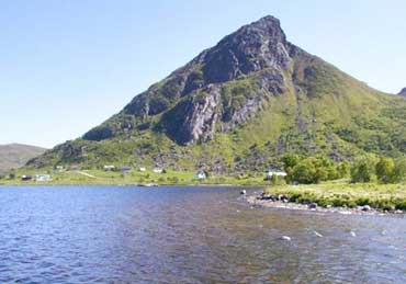
Charcoal pits, situated in outlaying fields at "Lannghanger". 650-750 m south-west of the farmhouses.
Furthest North:
1. Pit containing charcoal, 1 m in dm, 0.4 m in depth
18 m SSW of 1:
2. Charcoal pit 3, 5 m in dm
35 m WSW of 2:
3. Pit containing charcoal, 1 m in dm, 0, 5 m in depth
30 m SW of 3:
4. Charcoal pit, 4 m in dm
45 m W from 4:
5. Charcoal pit, 5 m in dm
About 3-4 m south from nr. 1, traces of another pit can be seen:
6. 0, 5 m in dm and 0,4 m indepth.
A possible charcoal pit is also localised c. 300 m S from the farm houses: 4, 5 m in dm
These structures were earlier defined as Sámi house sites, but redefined as charcoal pits in 2002.
Excavation Details
Not Available
Access/Ownership
Private property
References
- National Registrations from 1970, supplement registrations by Kåre Ringstad in 1978, Topographical Archive, Tromsø Museum
Check out the following sections of the website for related information:
Vestvågøy Sites and Artefacts
Mayo - Vestvågøy - Mid-Argyll
Travels in Time | Overview | Themes |
Timelines | 700BC to 0 | 0 to 800AD | 800AD to 1100AD |
Landscape | Mayo | Vestvågøy | Mid-Argyll | Archaeology |
Other Media | Education | Exhibition | Publication |
Information | Bibliography | Project | Links | Contact |
 This
project has been supported by the EU as part of the Culture
2000 programme.
This
project has been supported by the EU as part of the Culture
2000 programme.