
Vestvågøy
- 46
Rystad - Burial Mound and Farm
Mound
|
Site/Artefact Type Site
Number NGO Grid
Reference Map (
1:50000) List of Sites
and Artefacts Interactive
Map |
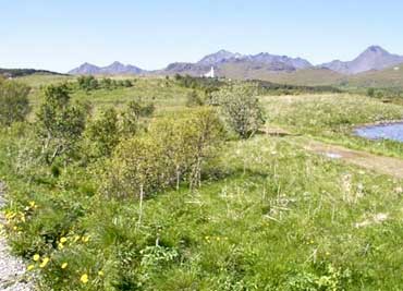 Overview of the Rystad-area (Photo: Lofotr, The Vikingmuseum) |
Description
|
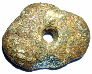
Burial mound: 13m long, 5m wide and 0.5m high. The burial mound is situated 100m west north west of the farmhouse. The Farm mound is situated in the same area, 20 x 35 m, cultural layers about 1 m thick. Finds: 2 hones of slate, shreds from soapstone vessels, 2 fragments of baking plates (plates of soapstone), and a small flake of flint. (Museumnumber TS 7096 a-d). Other finds submitted: Fish-weight of soap stone and a hone of slate, found close to the farm house. This could come from the farm-mound. Several more hones have been found at the farm earlier. Ts. 7034 a-b (museum number). |
|
Excavation Details
Not Available
Access/Ownership
Private property
References
- National Registrations: Topographical Archive, Museum of Tromsø
Check out the following sections of the website for related information:
Vestvågøy Sites and Artefacts
Mayo - Vestvågøy - Mid-Argyll
Travels in Time | Overview | Themes |
Timelines | 700BC to 0 | 0 to 800AD | 800AD to 1100AD |
Landscape | Mayo | Vestvågøy | Mid-Argyll | Archaeology |
Other Media | Education | Exhibition | Publication |
Information | Bibliography | Project | Links | Contact |
 This
project has been supported by the EU as part of the Culture
2000 programme.
This
project has been supported by the EU as part of the Culture
2000 programme.