
Vestvågøy
- 8
Holsøya
|
Site/Artefact Type Site
Number UTM Grid
Reference Map (
1:50000) List of Sites
and Artefacts Interactive
Map |
 All photos on this page taken by Wenche Brun
|
Description
 The
island became the property of the University of
Tromsø in 1969 for 35 000 Norwegian kronor.
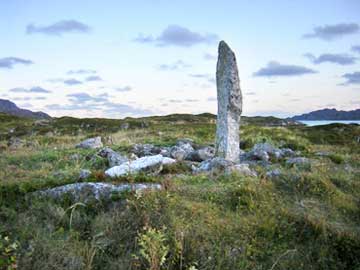
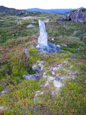
According to archaeological records there are
60 burial mounds
scattered into 6 separate fields:
The
island became the property of the University of
Tromsø in 1969 for 35 000 Norwegian kronor.
According to archaeological records there are
60 burial mounds
scattered into 6 separate fields:
a) 4 burial-cairns (R1 3155 08)
b) 3 burial-cairns (R2 3155 08)
c) Single grave-cairn at the highest point (R3 3155 08)
d) 21 cairns (R4 3155 08)
e) 7 cairns (R5 3155 08)
f) 24 cairns (R6 3155 08)
Excavation Details
Not Available
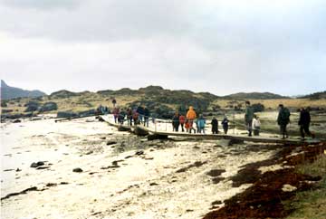
Access/Ownership
The island is property of the University of
Tromsø and is freely accessed. One problem
to reach it is the sea-level, which could be too
high at certain periods.
References
- Topographical archive, Museum of Tromsø
Vestvågøy Sites and Artefacts
Mayo - Vestvågøy - Mid-Argyll
Travels in Time | Overview | Themes |
Timelines | 700BC to 0 | 0 to 800AD | 800AD to 1100AD |
Landscape | Mayo | Vestvågøy | Mid-Argyll | Archaeology |
Other Media | Education | Exhibition | Publication |
Information | Bibliography | Project | Links | Contact |
 This
project has been supported by the EU as part of the Culture
2000 programme.
This
project has been supported by the EU as part of the Culture
2000 programme.